 California (Lassen Peak)
California (Lassen Peak)
|
|
Previous Page | Next Page |
Thank you goes out to the friendly police officer in Redding that let an idiot like me off with just a warning.
Starting on Monday, September 23, 2002, 7:16:16 AM
After my trip through the Redwoods I stopped a few places to take a nap or two. I cut across California along highway 299 to Redding. I was watching the street signs to try to catch highway 44, east, when I wasn't paying attention and accidentally ran through a red light. A police officer was coming the other direction as I went whizzing right past him. He immediately went off in pursuit and pulled me over just a few blocks away. He asked me all the standard questions and why I ran the light and what I was doing in Redding. I handed him a leaflet and as he seemed quite impressed he let me off with a warning and asked me to be more careful and actually seemed sincerely concerned about my well being.
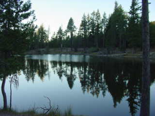
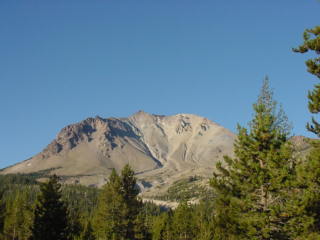
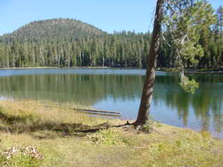
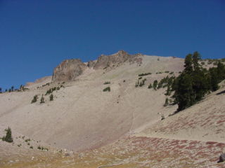
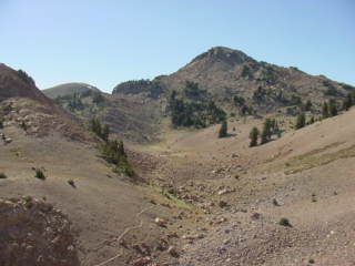
A little ways down the road I pulled off on highway 89, south towards Lassen State Park. Lassen State Park is actually a volcanic area. Lassen Peak stands over 10,000 feet and blew up with a violent eruption back in 1914. Like the St. Helens area it devastated the whole area around the mountain. This area has had quite a bit more time to recover so there does seem to be quite a bit of vegetation and it doesn't looked quite so desolate. However, even now, there are still areas close to the peak and along the blast zone that have not fully recovered and look quite different than the normal forests around that part of the country.
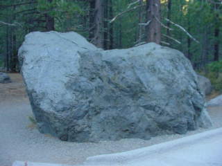
Here is a 300 ton chunk of lava rock that had tumbled and slid and was swept down the mountain to its final resting place here, 5 miles away.
Much of the mountain had grown over the years as the lava dome had pushed the peak back up further.
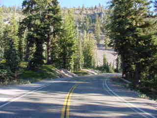
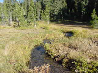
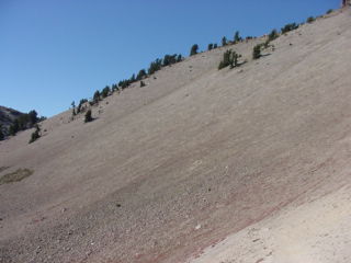
The surrounding area and roads were a blast to ride on as they were winding around the park.
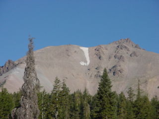
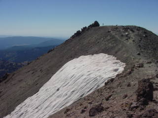
An interesting point here, the remaining snow across the summit there looked like a perfect "J" from the distance.
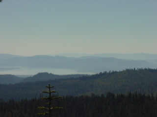
The scenery was really impressive. Much like some of the surrounding areas of St. Helens it is a refreshing view of an almost new world as the mountains had reshaped and transformed this land.
I climbed even higher and took more and more pictures of the surrounding landscape and panoramic views. I believe that this picture was taken from an altitude of about 7,000 feet.
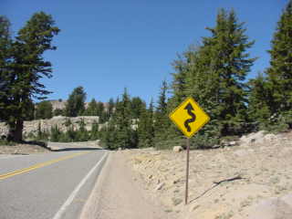
Oh yeah, there's another one of those signs. I love to see these. Maybe not so much in a car or a truck but on a motorcycle these roads are so much fun.
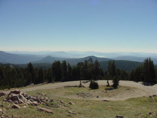
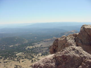
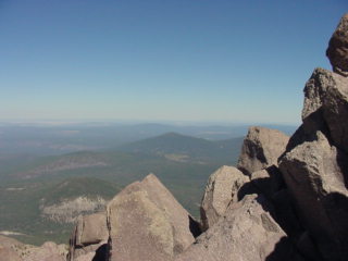
As I got even higher up these views are from about 8,500 feet. I made it to the top of the pass there and contemplated the hike up to the top of the volcano, to an altitude of about 10,500 feet.
It was still fairly early in the day so I decided to go ahead and make the trip. From 8,500 feet the air is still a little thinner than much lower altitudes so I was careful not to over exert myself.
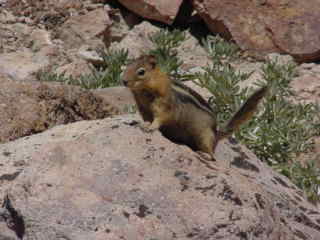
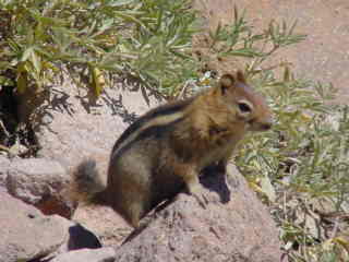
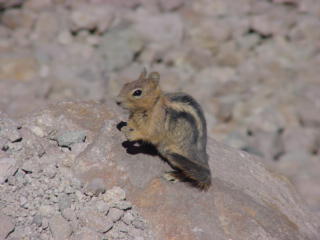
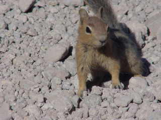
Along the way I stopped to get a few shots of the locals. Quite the hams, the chipmunks were trying their best to beg for a handout. I refused but appreciated the nice shots. Other than the grasshoppers and a few birds, these were the only creatures that I saw up on the mountain and along the hike.

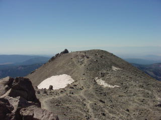
I stowed my camera throughout most of the hike until I got to the top. I figured that I could take all the pictures on the way back down. I had made it to the top much faster than expected so I hung around for a while and enjoyed the view. There were several other people that made the hike as well but only went to part of the summit. I hiked on over to the peak where I had to do a little rock scrambling to get to the very top of the peak. I figured if I had gone this far I might as well go the rest of the way so I made my way up to the highest point.
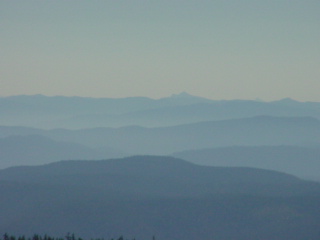
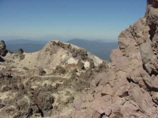
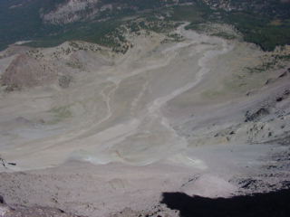
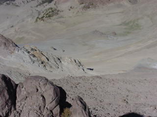
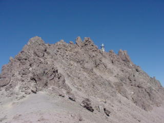
In the next image, way off in the distance you can just barely see Mt. Shasta there in the haze some 70 miles away. Then, looking back to the south and to the other side of the summit you can see some of the remaining snow on the left. This was the top of that "J" that was seen earlier from way below the mountain. Then the image on the right shows some of the extruded lava that had pushed its way back up in the crater. This was part of the crater as I was facing southwest.

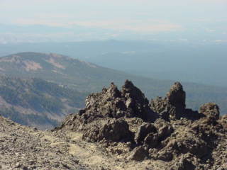
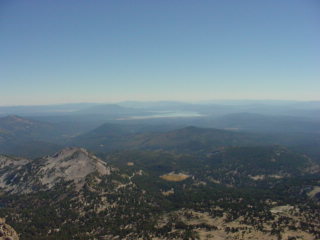
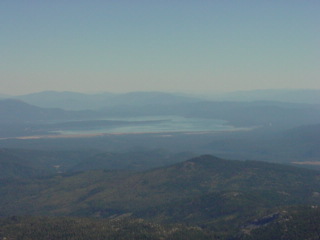
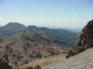
The crater of this volcano can only be seen from the top here. You can see some of the lava rock it in this next image, again with Mt. Shasta in the background. The next image is facing the southeast where you can see Lake Almanor.
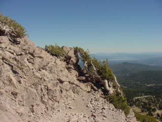
Climbing all around the rocks at the top of this peak I wanted to get as many shots of the surrounding area as possible. The image on the left is looking to the north as the next one, in the center is looking almost straight down the face of the mountain where the blast had taken much of the mountain. You can see that the vegetation has still not yet recovered over the years.
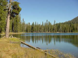
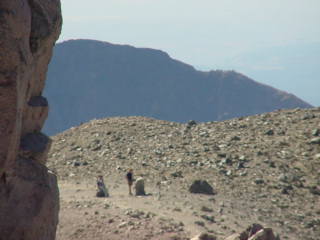
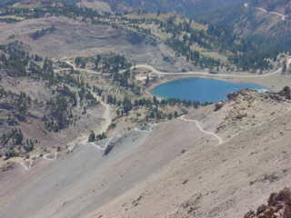
Looking back to the other side is some people that didn't make it over to the top. I still don't understand why they didn't make the effort to go up there. The next image is looking back and zooming in to see the small Lake Helen just further down the road. You can also see parts of the trail leading up the mountain side. The next image shows a little closer look at the top of the snow and the other side of the summit.
Another zoomed in image of Lake Almanor about 20 miles in the distance. Then, as I hiked back I took this next picture of the very top of the peak where I had just been. Then again showing Mt. Shasta in the distance from across the crater

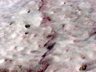
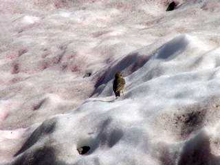
I got up and close to the top of the snow to get a batter look and actually touch it. I couldn't figure out why the snow had little patches of red and pink in it. It almost looked as if somebody had spilled Cool-Aid in the snow. Then there was this small bird dancing around on the snow.

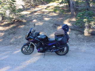
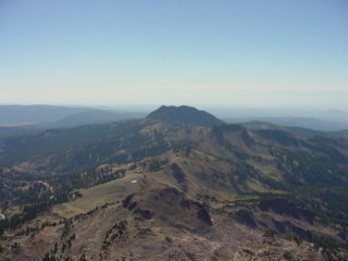
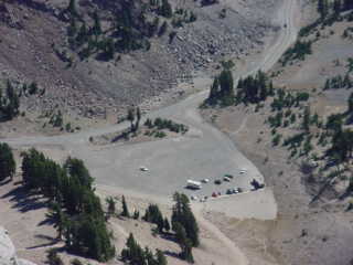
As I made my descent I got a few more images. The first one below is of the other mountain, Mt. Tehama. This volcanic mountain, at one time, was even estimated to be taller than the Lassen peak. It is speculated that it had erupted and then was torn down even more over the centuries by glacial erosion. The image to the right is looking back down to the parking lot where my bike was parked. Yeah, its one of those tiny dots. Actually the smallest one. Earlier, before making my ascent of Lassen Peak, I had hiked and hidden some of my more valuable items on another hill, under some trees and brush. I still had to leave the bike there, vulnerable to any looters. Looking back down into the parking lot from this distance I thought to myself that, even if I could see somebody stealing something, I couldn't have done a thing about it.
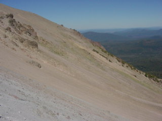
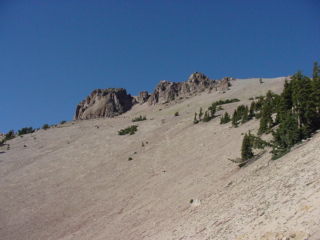
In these images you can see some of the slopes along the trail with the landscape in the background.
Again, another one of the locals wanted to gets its face in the shot.

Here, almost to the bottom of the trail is looking back across and up to parts of the mountain.
It was quite a hike but it wasn't all that bad. The hard part was hiking back over to the other hill where I had hidden some of my valuables. Having gotten to the bottom, I really didn't feel like doing any more hiking.
So its off to see more sights. On south to highway 36, east and then to 395 that heads south and into Reno, NV.
|
|
Previous Page | Next Page |

Copyright © 2002 Galixy Productions, Galixy.net. All rights reserved.